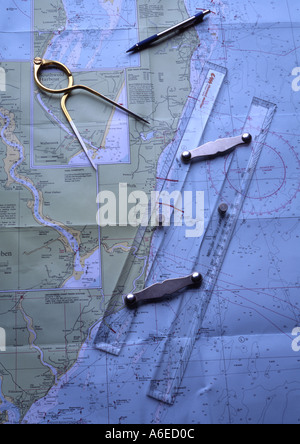
 Grafico del Mare del Nord che mostra costa est di East Anglia Foto Stockhttps://www.alamy.it/image-license-details/?v=1https://www.alamy.it/grafico-del-mare-del-nord-che-mostra-costa-est-di-east-anglia-image453900.html
RMA6ED0C–Grafico del Mare del Nord che mostra costa est di East Anglia
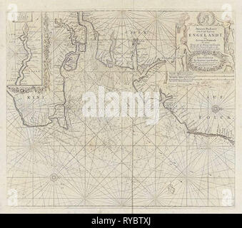 Diagramma del mare di parte della costa orientale dell'Inghilterra alla foce del Tamigi, Jan Luyken, anonimo, Johannes Van Keulen (MI), 1681 - 1803 Foto Stockhttps://www.alamy.it/image-license-details/?v=1https://www.alamy.it/diagramma-del-mare-di-parte-della-costa-orientale-dell-inghilterra-alla-foce-del-tamigi-jan-luyken-anonimo-johannes-van-keulen-mi-1681-1803-image240591530.html
RMRYBTXJ–Diagramma del mare di parte della costa orientale dell'Inghilterra alla foce del Tamigi, Jan Luyken, anonimo, Johannes Van Keulen (MI), 1681 - 1803
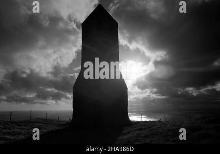 AJAXNETPHOTO. 1970. ST. CATHERINE'S HILL, ISOLA DI WIGHT, INGHILTERRA. - 14TH SECOLO MARCHIO DEL MARE - TORRE COSTRUITA COME FARO ALLA PUNTA MERIDIONALE DELL'ISOLA ALL'INIZIO DEL 14TH SECOLO. RESTI DI ORATORIO DEMOLITO DAL TEMPO DI ENRICO VIII GIACCIONO A EST DI QUESTO MARCHIO. PHOTO:JONATHAN EASTLAND/AJAX REF:211811 18 Foto Stockhttps://www.alamy.it/image-license-details/?v=1https://www.alamy.it/ajaxnetphoto-1970-st-catherines-hill-isola-di-wight-inghilterra-14th-secolo-marchio-del-mare-torre-costruita-come-faro-alla-punta-meridionale-dell-isola-all-inizio-del-14th-secolo-resti-di-oratorio-demolito-dal-tempo-di-enrico-viii-giacciono-a-est-di-questo-marchio-photo-jonathan-eastland-ajax-ref-211811-18-image453820149.html
RM2HA986D–AJAXNETPHOTO. 1970. ST. CATHERINE'S HILL, ISOLA DI WIGHT, INGHILTERRA. - 14TH SECOLO MARCHIO DEL MARE - TORRE COSTRUITA COME FARO ALLA PUNTA MERIDIONALE DELL'ISOLA ALL'INIZIO DEL 14TH SECOLO. RESTI DI ORATORIO DEMOLITO DAL TEMPO DI ENRICO VIII GIACCIONO A EST DI QUESTO MARCHIO. PHOTO:JONATHAN EASTLAND/AJAX REF:211811 18
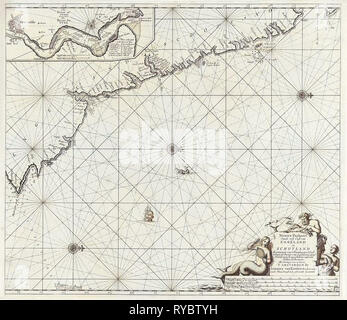 Diagramma del mare di parte della costa nord-orientale dell'Inghilterra e parte della Scozia, Jan Luyken, Johannes Van Keulen (MI), sconosciuto, 1681 - 1799 Foto Stockhttps://www.alamy.it/image-license-details/?v=1https://www.alamy.it/diagramma-del-mare-di-parte-della-costa-nord-orientale-dell-inghilterra-e-parte-della-scozia-jan-luyken-johannes-van-keulen-mi-sconosciuto-1681-1799-image240591557.html
RMRYBTYH–Diagramma del mare di parte della costa nord-orientale dell'Inghilterra e parte della Scozia, Jan Luyken, Johannes Van Keulen (MI), sconosciuto, 1681 - 1799
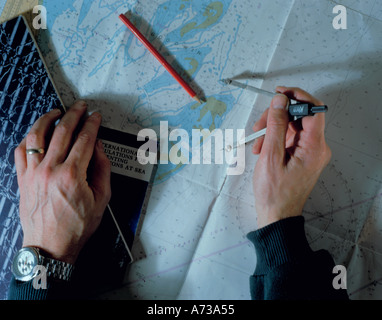 Navigazione nautica; Grafico copre parte del Goodwin Sands, off est costa inglese, UK. Foto Stockhttps://www.alamy.it/image-license-details/?v=1https://www.alamy.it/navigazione-nautica-grafico-copre-parte-del-goodwin-sands-off-est-costa-inglese-uk-image473685.html
RMA73A55–Navigazione nautica; Grafico copre parte del Goodwin Sands, off est costa inglese, UK.
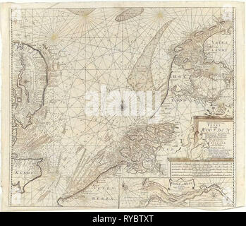 Diagramma di mare della parte meridionale del Mare del Nord e parte della costa orientale dell'Inghilterra, Gerard Van Keulen, Johannes Van Keulen (MI), sconosciuto, 1688 - 1803 Foto Stockhttps://www.alamy.it/image-license-details/?v=1https://www.alamy.it/diagramma-di-mare-della-parte-meridionale-del-mare-del-nord-e-parte-della-costa-orientale-dell-inghilterra-gerard-van-keulen-johannes-van-keulen-mi-sconosciuto-1688-1803-image240591536.html
RMRYBTXT–Diagramma di mare della parte meridionale del Mare del Nord e parte della costa orientale dell'Inghilterra, Gerard Van Keulen, Johannes Van Keulen (MI), sconosciuto, 1688 - 1803
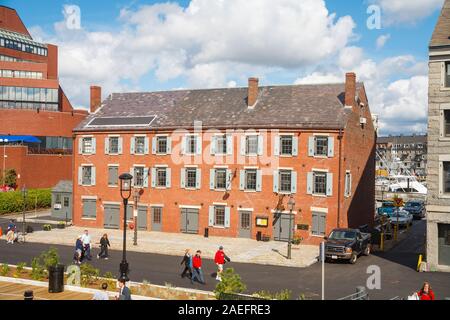 Vista dello storico edificio Gardiner ora Chart House su Long Wharf (Sud) nel quartiere lungomare di Boston, Massachusetts, New England, STATI UNITI D'AMERICA Foto Stockhttps://www.alamy.it/image-license-details/?v=1https://www.alamy.it/vista-dello-storico-edificio-gardiner-ora-chart-house-su-long-wharf-sud-nel-quartiere-lungomare-di-boston-massachusetts-new-england-stati-uniti-d-america-image335949883.html
RM2AEFRE3–Vista dello storico edificio Gardiner ora Chart House su Long Wharf (Sud) nel quartiere lungomare di Boston, Massachusetts, New England, STATI UNITI D'AMERICA
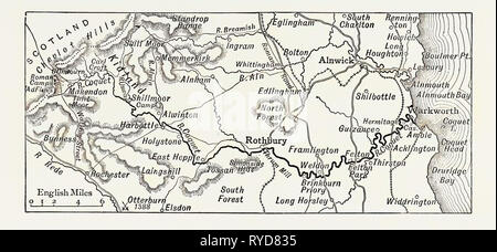 Mappa del corso del Coquet, UK. Il fiume Coquet corre attraverso la contea di Northumberland, Inghilterra, lo scarico in mare del Nord sulla costa orientale dell'Inghilterra a camminare Foto Stockhttps://www.alamy.it/image-license-details/?v=1https://www.alamy.it/mappa-del-corso-del-coquet-uk-il-fiume-coquet-corre-attraverso-la-contea-di-northumberland-inghilterra-lo-scarico-in-mare-del-nord-sulla-costa-orientale-dell-inghilterra-a-camminare-image240622233.html
RMRYD835–Mappa del corso del Coquet, UK. Il fiume Coquet corre attraverso la contea di Northumberland, Inghilterra, lo scarico in mare del Nord sulla costa orientale dell'Inghilterra a camminare
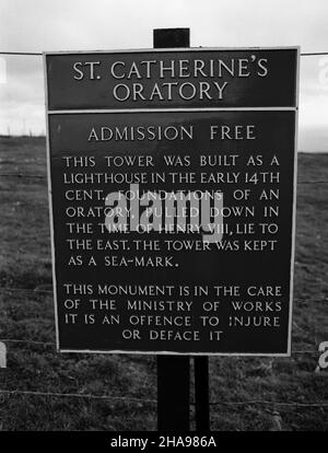 AJAXNETPHOTO. 1970. ST. CATHERINE'S HILL, ISOLA DI WIGHT, INGHILTERRA. - 14TH SECOLO MARCHIO DEL MARE - TORRE COSTRUITA COME FARO ALLA PUNTA MERIDIONALE DELL'ISOLA ALL'INIZIO DEL 14TH SECOLO. RESTI DI ORATORIO DEMOLITO DAL TEMPO DI ENRICO VIII GIACCIONO A EST DI QUESTO MARCHIO. PHOTO:JONATHAN EASTLAND/AJAX REF:211811 17 Foto Stockhttps://www.alamy.it/image-license-details/?v=1https://www.alamy.it/ajaxnetphoto-1970-st-catherines-hill-isola-di-wight-inghilterra-14th-secolo-marchio-del-mare-torre-costruita-come-faro-alla-punta-meridionale-dell-isola-all-inizio-del-14th-secolo-resti-di-oratorio-demolito-dal-tempo-di-enrico-viii-giacciono-a-est-di-questo-marchio-photo-jonathan-eastland-ajax-ref-211811-17-image453820146.html
RM2HA986A–AJAXNETPHOTO. 1970. ST. CATHERINE'S HILL, ISOLA DI WIGHT, INGHILTERRA. - 14TH SECOLO MARCHIO DEL MARE - TORRE COSTRUITA COME FARO ALLA PUNTA MERIDIONALE DELL'ISOLA ALL'INIZIO DEL 14TH SECOLO. RESTI DI ORATORIO DEMOLITO DAL TEMPO DI ENRICO VIII GIACCIONO A EST DI QUESTO MARCHIO. PHOTO:JONATHAN EASTLAND/AJAX REF:211811 17
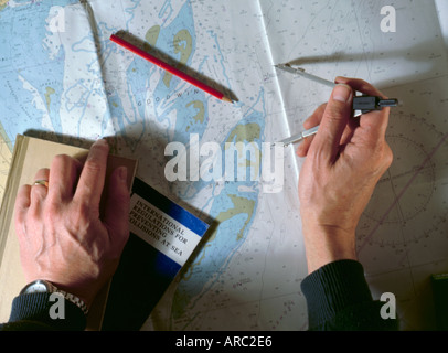 Navigazione nautica; grafico copre parte del goodwin sands, off est costa inglese, UK. Foto Stockhttps://www.alamy.it/image-license-details/?v=1https://www.alamy.it/navigazione-nautica-grafico-copre-parte-del-goodwin-sands-off-est-costa-inglese-uk-image1557221.html
RMARC2E6–Navigazione nautica; grafico copre parte del goodwin sands, off est costa inglese, UK.
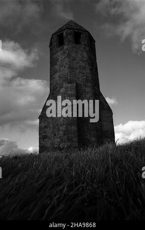 AJAXNETPHOTO. 1970. ST. CATHERINE'S HILL, ISOLA DI WIGHT, INGHILTERRA. - 14TH SECOLO MARCHIO DEL MARE - TORRE COSTRUITA COME FARO ALLA PUNTA MERIDIONALE DELL'ISOLA ALL'INIZIO DEL 14TH SECOLO. RESTI DI ORATORIO DEMOLITO DAL TEMPO DI ENRICO VIII GIACCIONO A EST DI QUESTO MARCHIO. PHOTO:JONATHAN EASTLAND/AJAX REF:211811 16 Foto Stockhttps://www.alamy.it/image-license-details/?v=1https://www.alamy.it/ajaxnetphoto-1970-st-catherines-hill-isola-di-wight-inghilterra-14th-secolo-marchio-del-mare-torre-costruita-come-faro-alla-punta-meridionale-dell-isola-all-inizio-del-14th-secolo-resti-di-oratorio-demolito-dal-tempo-di-enrico-viii-giacciono-a-est-di-questo-marchio-photo-jonathan-eastland-ajax-ref-211811-16-image453820144.html
RM2HA9868–AJAXNETPHOTO. 1970. ST. CATHERINE'S HILL, ISOLA DI WIGHT, INGHILTERRA. - 14TH SECOLO MARCHIO DEL MARE - TORRE COSTRUITA COME FARO ALLA PUNTA MERIDIONALE DELL'ISOLA ALL'INIZIO DEL 14TH SECOLO. RESTI DI ORATORIO DEMOLITO DAL TEMPO DI ENRICO VIII GIACCIONO A EST DI QUESTO MARCHIO. PHOTO:JONATHAN EASTLAND/AJAX REF:211811 16