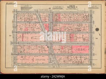
 Cartografica, Mappe. 1927. Lionel Pincus e la Principessa Firyal Map Division. Real Property , New York (state) , New York, Manhattan (New York, N.Y.) Piastra 60, parte della sezione 3: Delimitata da W. 37th Street, Fifth Avenue, W. 32nd Street e Seventh Avenue Foto Stockhttps://www.alamy.it/image-license-details/?v=1https://www.alamy.it/cartografica-mappe-1927-lionel-pincus-e-la-principessa-firyal-map-division-real-property-new-york-state-new-york-manhattan-new-york-n-y-piastra-60-parte-della-sezione-3-delimitata-da-w-37th-street-fifth-avenue-w-32nd-street-e-seventh-avenue-image483688530.html
RM2K2WWJA–Cartografica, Mappe. 1927. Lionel Pincus e la Principessa Firyal Map Division. Real Property , New York (state) , New York, Manhattan (New York, N.Y.) Piastra 60, parte della sezione 3: Delimitata da W. 37th Street, Fifth Avenue, W. 32nd Street e Seventh Avenue
![Targa 60, parte della sezione 3: [Delimitata da W. 37th Street, Fifth Avenue, W. 32nd Street e Seventh Avenue.] 1955 Foto Stock Targa 60, parte della sezione 3: [Delimitata da W. 37th Street, Fifth Avenue, W. 32nd Street e Seventh Avenue.] 1955 Foto Stock](https://l450v.alamy.com/450vit/2yrccyt/targa-60-parte-della-sezione-3-delimitata-da-w-37th-street-fifth-avenue-w-32nd-street-e-seventh-avenue-1955-2yrccyt.jpg) Targa 60, parte della sezione 3: [Delimitata da W. 37th Street, Fifth Avenue, W. 32nd Street e Seventh Avenue.] 1955 Foto Stockhttps://www.alamy.it/image-license-details/?v=1https://www.alamy.it/targa-60-parte-della-sezione-3-delimitata-da-w-37th-street-fifth-avenue-w-32nd-street-e-seventh-avenue-1955-image633983948.html
Targa 60, parte della sezione 3: [Delimitata da W. 37th Street, Fifth Avenue, W. 32nd Street e Seventh Avenue.] 1955 Foto Stockhttps://www.alamy.it/image-license-details/?v=1https://www.alamy.it/targa-60-parte-della-sezione-3-delimitata-da-w-37th-street-fifth-avenue-w-32nd-street-e-seventh-avenue-1955-image633983948.htmlRM2YRCCYT–Targa 60, parte della sezione 3: [Delimitata da W. 37th Street, Fifth Avenue, W. 32nd Street e Seventh Avenue.] 1955
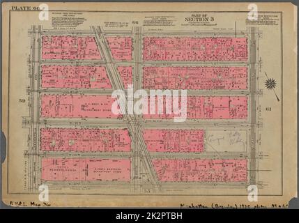 Cartografica, Mappe. 1930. Lionel Pincus e la Principessa Firyal Map Division. Real Property , New York (state) , New York, Manhattan (New York, N.Y.) Piastra 60, parte della sezione 3: Delimitata da W. 37th Street, Fifth Avenue, W. 32nd Street e Seventh Avenue Foto Stockhttps://www.alamy.it/image-license-details/?v=1https://www.alamy.it/cartografica-mappe-1930-lionel-pincus-e-la-principessa-firyal-map-division-real-property-new-york-state-new-york-manhattan-new-york-n-y-piastra-60-parte-della-sezione-3-delimitata-da-w-37th-street-fifth-avenue-w-32nd-street-e-seventh-avenue-image483621701.html
RM2K2PTBH–Cartografica, Mappe. 1930. Lionel Pincus e la Principessa Firyal Map Division. Real Property , New York (state) , New York, Manhattan (New York, N.Y.) Piastra 60, parte della sezione 3: Delimitata da W. 37th Street, Fifth Avenue, W. 32nd Street e Seventh Avenue
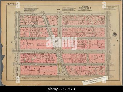 Cartografica, Mappe. 1925. Lionel Pincus e la Principessa Firyal Map Division. Real Property , New York (state) , New York, Manhattan (New York, N.Y.) Piastra 60, parte della sezione 3: Delimitata da W. 37th Street, Fifth Avenue, W. 32nd Street e Seventh Avenue Foto Stockhttps://www.alamy.it/image-license-details/?v=1https://www.alamy.it/cartografica-mappe-1925-lionel-pincus-e-la-principessa-firyal-map-division-real-property-new-york-state-new-york-manhattan-new-york-n-y-piastra-60-parte-della-sezione-3-delimitata-da-w-37th-street-fifth-avenue-w-32nd-street-e-seventh-avenue-image483623711.html
RM2K2PXYB–Cartografica, Mappe. 1925. Lionel Pincus e la Principessa Firyal Map Division. Real Property , New York (state) , New York, Manhattan (New York, N.Y.) Piastra 60, parte della sezione 3: Delimitata da W. 37th Street, Fifth Avenue, W. 32nd Street e Seventh Avenue
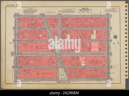 Cartografica, Mappe. 1955 - 1956. Lionel Pincus e la Principessa Firyal Map Division. Real Property , New York (state) , New York (N.Y.), Manhattan (New York, N.Y.) Piastra 60, parte della sezione 3: Delimitata da W. 37th Street, Fifth Avenue, W. 32nd Street e Seventh Avenue. Foto Stockhttps://www.alamy.it/image-license-details/?v=1https://www.alamy.it/cartografica-mappe-1955-1956-lionel-pincus-e-la-principessa-firyal-map-division-real-property-new-york-state-new-york-n-y-manhattan-new-york-n-y-piastra-60-parte-della-sezione-3-delimitata-da-w-37th-street-fifth-avenue-w-32nd-street-e-seventh-avenue-image483639736.html
RM2K2RKBM–Cartografica, Mappe. 1955 - 1956. Lionel Pincus e la Principessa Firyal Map Division. Real Property , New York (state) , New York (N.Y.), Manhattan (New York, N.Y.) Piastra 60, parte della sezione 3: Delimitata da W. 37th Street, Fifth Avenue, W. 32nd Street e Seventh Avenue.
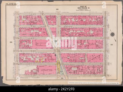 Cartografica, Mappe. 1916. Lionel Pincus e la Principessa Firyal Map Division. Atlas, Manhattan (New York, N.Y.), Real Property, New York (state), New York Plate 60: Delimitata da W. 37th Street, Fifth Avenue, W. 32nd Street e Seventh Avenue parte della Sezione 3 Foto Stockhttps://www.alamy.it/image-license-details/?v=1https://www.alamy.it/cartografica-mappe-1916-lionel-pincus-e-la-principessa-firyal-map-division-atlas-manhattan-new-york-n-y-real-property-new-york-state-new-york-plate-60-delimitata-da-w-37th-street-fifth-avenue-w-32nd-street-e-seventh-avenue-parte-della-sezione-3-image483714308.html
RM2K2Y2F0–Cartografica, Mappe. 1916. Lionel Pincus e la Principessa Firyal Map Division. Atlas, Manhattan (New York, N.Y.), Real Property, New York (state), New York Plate 60: Delimitata da W. 37th Street, Fifth Avenue, W. 32nd Street e Seventh Avenue parte della Sezione 3
![Targa 60, parte della sezione 3: [Delimitata da W. 37th Street, Fifth Avenue, W. 32nd Street e Seventh Avenue] 1930 Foto Stock Targa 60, parte della sezione 3: [Delimitata da W. 37th Street, Fifth Avenue, W. 32nd Street e Seventh Avenue] 1930 Foto Stock](https://l450v.alamy.com/450vit/2yr8raw/targa-60-parte-della-sezione-3-delimitata-da-w-37th-street-fifth-avenue-w-32nd-street-e-seventh-avenue-1930-2yr8raw.jpg) Targa 60, parte della sezione 3: [Delimitata da W. 37th Street, Fifth Avenue, W. 32nd Street e Seventh Avenue] 1930 Foto Stockhttps://www.alamy.it/image-license-details/?v=1https://www.alamy.it/targa-60-parte-della-sezione-3-delimitata-da-w-37th-street-fifth-avenue-w-32nd-street-e-seventh-avenue-1930-image633904289.html
Targa 60, parte della sezione 3: [Delimitata da W. 37th Street, Fifth Avenue, W. 32nd Street e Seventh Avenue] 1930 Foto Stockhttps://www.alamy.it/image-license-details/?v=1https://www.alamy.it/targa-60-parte-della-sezione-3-delimitata-da-w-37th-street-fifth-avenue-w-32nd-street-e-seventh-avenue-1930-image633904289.htmlRM2YR8RAW–Targa 60, parte della sezione 3: [Delimitata da W. 37th Street, Fifth Avenue, W. 32nd Street e Seventh Avenue] 1930
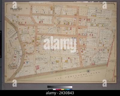 Cartografica, Mappe. 1901. Lionel Pincus e la Principessa Firyal Map Division. Bronx (New York, N.Y.), Real Property , New York (state) , New York Double Page Plate No. 60, parte di Ward 24, Sezione 13: Delimitata da Delafield Avenue, W. 263rd Street, Broadway e Faraday Avenue Foto Stockhttps://www.alamy.it/image-license-details/?v=1https://www.alamy.it/cartografica-mappe-1901-lionel-pincus-e-la-principessa-firyal-map-division-bronx-new-york-n-y-real-property-new-york-state-new-york-double-page-plate-no-60-parte-di-ward-24-sezione-13-delimitata-da-delafield-avenue-w-263rd-street-broadway-e-faraday-avenue-image483743011.html
RM2K30B43–Cartografica, Mappe. 1901. Lionel Pincus e la Principessa Firyal Map Division. Bronx (New York, N.Y.), Real Property , New York (state) , New York Double Page Plate No. 60, parte di Ward 24, Sezione 13: Delimitata da Delafield Avenue, W. 263rd Street, Broadway e Faraday Avenue
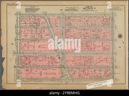 Delimitato da W. 37th Street, Fifth Avenue, W. 32nd Street e Seventh Avenue, Plate 60, parte della sezione 3 1925 Foto Stockhttps://www.alamy.it/image-license-details/?v=1https://www.alamy.it/delimitato-da-w-37th-street-fifth-avenue-w-32nd-street-e-seventh-avenue-plate-60-parte-della-sezione-3-1925-image633902124.html
RM2YR8MHG–Delimitato da W. 37th Street, Fifth Avenue, W. 32nd Street e Seventh Avenue, Plate 60, parte della sezione 3 1925
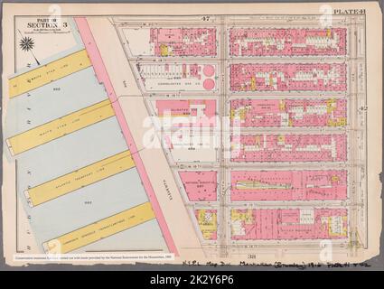 Cartografica, Mappe. 1916. Lionel Pincus e la Principessa Firyal Map Division. Atlases, Manhattan (New York, N.Y.), Real Property , New York (state) , New York Plate 41: Bounded by W. 20th Street, Ninth Avenue, W. 14th Street, and (Piers 57-60) Undicesima Avenue Part of Section 3 Foto Stockhttps://www.alamy.it/image-license-details/?v=1https://www.alamy.it/cartografica-mappe-1916-lionel-pincus-e-la-principessa-firyal-map-division-atlases-manhattan-new-york-n-y-real-property-new-york-state-new-york-plate-41-bounded-by-w-20th-street-ninth-avenue-w-14th-street-and-piers-57-60-undicesima-avenue-part-of-section-3-image483717646.html
RM2K2Y6P6–Cartografica, Mappe. 1916. Lionel Pincus e la Principessa Firyal Map Division. Atlases, Manhattan (New York, N.Y.), Real Property , New York (state) , New York Plate 41: Bounded by W. 20th Street, Ninth Avenue, W. 14th Street, and (Piers 57-60) Undicesima Avenue Part of Section 3
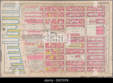 Cartografica, Mappe. 1911. Lionel Pincus e la Principessa Firyal Map Division. New York (N.Y.), Manhattan (New York, N.Y.), Real Property , New York (state) , New York , Manhattan Plate 18: Delimitata da W. 36th Street, Eighth Avenue, W. 25th Street, Thirenth Avenue, Hudson River, Moli 55-60, e Hudson River, moli 61-66, Twelfth Avenue. Parte della Sezione 3, New York City. Foto Stockhttps://www.alamy.it/image-license-details/?v=1https://www.alamy.it/cartografica-mappe-1911-lionel-pincus-e-la-principessa-firyal-map-division-new-york-n-y-manhattan-new-york-n-y-real-property-new-york-state-new-york-manhattan-plate-18-delimitata-da-w-36th-street-eighth-avenue-w-25th-street-thirenth-avenue-hudson-river-moli-55-60-e-hudson-river-moli-61-66-twelfth-avenue-parte-della-sezione-3-new-york-city-image483733479.html
RM2K2YXYK–Cartografica, Mappe. 1911. Lionel Pincus e la Principessa Firyal Map Division. New York (N.Y.), Manhattan (New York, N.Y.), Real Property , New York (state) , New York , Manhattan Plate 18: Delimitata da W. 36th Street, Eighth Avenue, W. 25th Street, Thirenth Avenue, Hudson River, Moli 55-60, e Hudson River, moli 61-66, Twelfth Avenue. Parte della Sezione 3, New York City.
![Double Page Plate No. 60, Part of Ward 24, Section 13: [Delimitata da Delafield Avenue, W. 263rd Street, Broadway and Faraday Avenue] 1901 Foto Stock Double Page Plate No. 60, Part of Ward 24, Section 13: [Delimitata da Delafield Avenue, W. 263rd Street, Broadway and Faraday Avenue] 1901 Foto Stock](https://l450v.alamy.com/450vit/2yp9hyb/double-page-plate-no-60-part-of-ward-24-section-13-delimitata-da-delafield-avenue-w-263rd-street-broadway-and-faraday-avenue-1901-2yp9hyb.jpg) Double Page Plate No. 60, Part of Ward 24, Section 13: [Delimitata da Delafield Avenue, W. 263rd Street, Broadway and Faraday Avenue] 1901 Foto Stockhttps://www.alamy.it/image-license-details/?v=1https://www.alamy.it/double-page-plate-no-60-part-of-ward-24-section-13-delimitata-da-delafield-avenue-w-263rd-street-broadway-and-faraday-avenue-1901-image633307343.html
Double Page Plate No. 60, Part of Ward 24, Section 13: [Delimitata da Delafield Avenue, W. 263rd Street, Broadway and Faraday Avenue] 1901 Foto Stockhttps://www.alamy.it/image-license-details/?v=1https://www.alamy.it/double-page-plate-no-60-part-of-ward-24-section-13-delimitata-da-delafield-avenue-w-263rd-street-broadway-and-faraday-avenue-1901-image633307343.htmlRM2YP9HYB–Double Page Plate No. 60, Part of Ward 24, Section 13: [Delimitata da Delafield Avenue, W. 263rd Street, Broadway and Faraday Avenue] 1901