11245 x 11137 px | 95,2 x 94,3 cm | 37,5 x 37,1 inches | 300dpi
Data acquisizione:
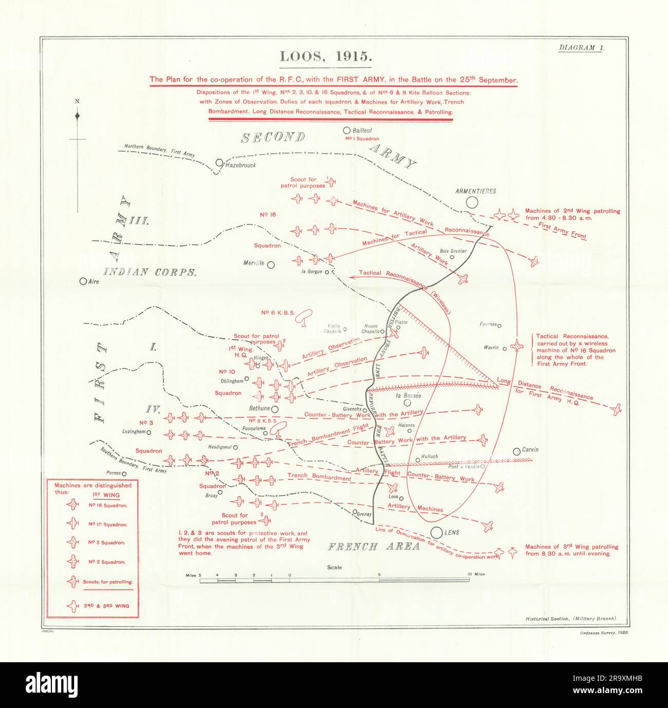
1927
Ubicazione:
Pas-de-Calais & Nord
Altre informazioni:
Questa immagine potrebbe avere delle imperfezioni perché è storica o di reportage.
Loos, 1915. The Plan for the co-operation of the R. F. C., with the First Army, in the Battle on the 25th September. Dispositions of the 1st Wing, No 2, 3, 10 & 16 Squadrons, & of No 6 & 8 Kite Balloon Sections; with Zone of Observation, Duties of each squadron, & Machines for Artillery Work, Trench Bombardment, Long Distance Reconnaissance, Tactival Reconnaissance & Patrolling [Battle of Loos]. Artist/engraver/cartographer: Map compiled by Major Archibald Frank Becke. Published by Ordnance Survey 1928. Provenance: "History of the Great War based on Official Documents by the Direction of the Historical Section of the Committee of Imperial Defence. Military Operations France and Belgium, 1915". Compiled by Brigadier-General Sir James E. Edmonds. Maps and Sketches compiled by Major A. F. Becke. Published by MacMillan and Co; Limited St. Martin's Street, London 1927. Type: Antique military history map.