Lesotho town Immagini Stock Ritagliate
(61)Lesotho town Immagini Stock Ritagliate
 Possibile di Maluti locale premium lager birra, MASERU Maseru District, Regno di Lesotho Foto Stockhttps://www.alamy.it/image-license-details/?v=1https://www.alamy.it/foto-immagine-possibile-di-maluti-locale-premium-lager-birra-maseru-maseru-district-regno-di-lesotho-138103000.html
RMJ0K3P0–Possibile di Maluti locale premium lager birra, MASERU Maseru District, Regno di Lesotho
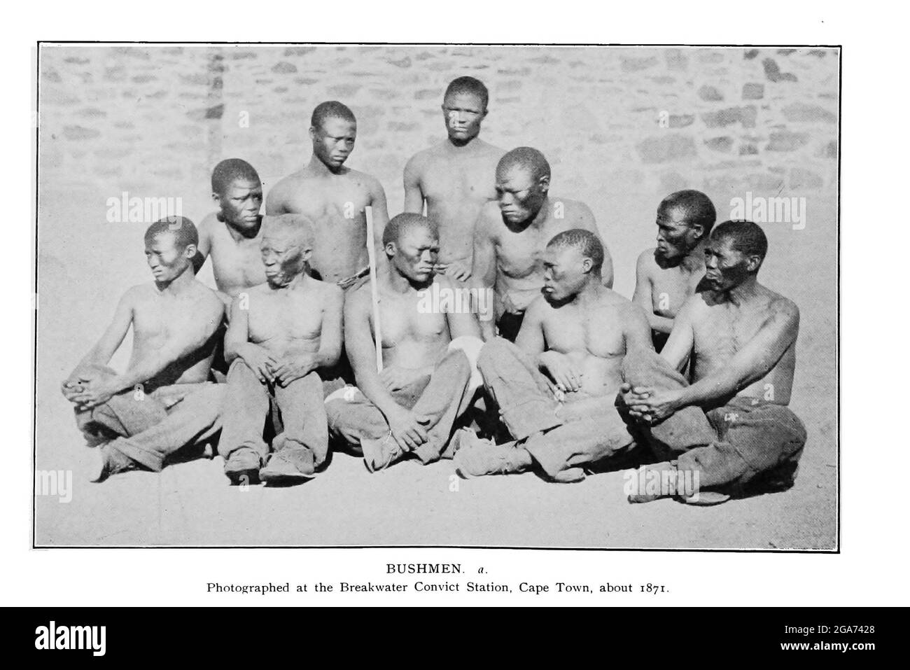 Fotografato a Breakwater, Città del Capo 1871 dal libro ' esemplari di folklore dei Boscimani ' di Bleek, W. H. I. (Wilhelm Heinrich Immanuel), Lloyd, Lucy Catherine, Theal, George McCall, 1837-1919 pubblicato a Londra da G. Allen & Company, ltd. Nel 1911. I popoli dei San (anche Saan), o Boscimani, sono membri di vari gruppi di cacciatori-raccoglitori indigeni di lingua khoe, Tuu, o Kxʼa, che sono le prime nazioni dell'Africa meridionale, e i cui territori si estendono dal Botswana, dalla Namibia, dall'Angola, dallo Zambia, dallo Zimbabwe, Lesotho e Sud Africa. Foto Stockhttps://www.alamy.it/image-license-details/?v=1https://www.alamy.it/fotografato-a-breakwater-citta-del-capo-1871-dal-libro-esemplari-di-folklore-dei-boscimani-di-bleek-w-h-i-wilhelm-heinrich-immanuel-lloyd-lucy-catherine-theal-george-mccall-1837-1919-pubblicato-a-londra-da-g-allen-company-ltd-nel-1911-i-popoli-dei-san-anche-saan-o-boscimani-sono-membri-di-vari-gruppi-di-cacciatori-raccoglitori-indigeni-di-lingua-khoe-tuu-o-kx-a-che-sono-le-prime-nazioni-dell-africa-meridionale-e-i-cui-territori-si-estendono-dal-botswana-dalla-namibia-dall-angola-dallo-zambia-dallo-zimbabwe-lesotho-e-sud-africa-image436562624.html
RM2GA7428–Fotografato a Breakwater, Città del Capo 1871 dal libro ' esemplari di folklore dei Boscimani ' di Bleek, W. H. I. (Wilhelm Heinrich Immanuel), Lloyd, Lucy Catherine, Theal, George McCall, 1837-1919 pubblicato a Londra da G. Allen & Company, ltd. Nel 1911. I popoli dei San (anche Saan), o Boscimani, sono membri di vari gruppi di cacciatori-raccoglitori indigeni di lingua khoe, Tuu, o Kxʼa, che sono le prime nazioni dell'Africa meridionale, e i cui territori si estendono dal Botswana, dalla Namibia, dall'Angola, dallo Zambia, dallo Zimbabwe, Lesotho e Sud Africa.
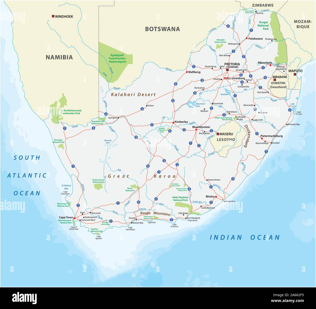 Sud Africa road e il Parco Nazionale di mappa Illustrazione Vettorialehttps://www.alamy.it/image-license-details/?v=1https://www.alamy.it/sud-africa-road-e-il-parco-nazionale-di-mappa-image330818631.html
RF2A662F3–Sud Africa road e il Parco Nazionale di mappa
 Lesotho e Sudafrica grunge bandiere connessione, vettore Illustrazione Vettorialehttps://www.alamy.it/image-license-details/?v=1https://www.alamy.it/lesotho-e-sudafrica-grunge-bandiere-connessione-vettore-image600177446.html
RF2WTCCCP–Lesotho e Sudafrica grunge bandiere connessione, vettore
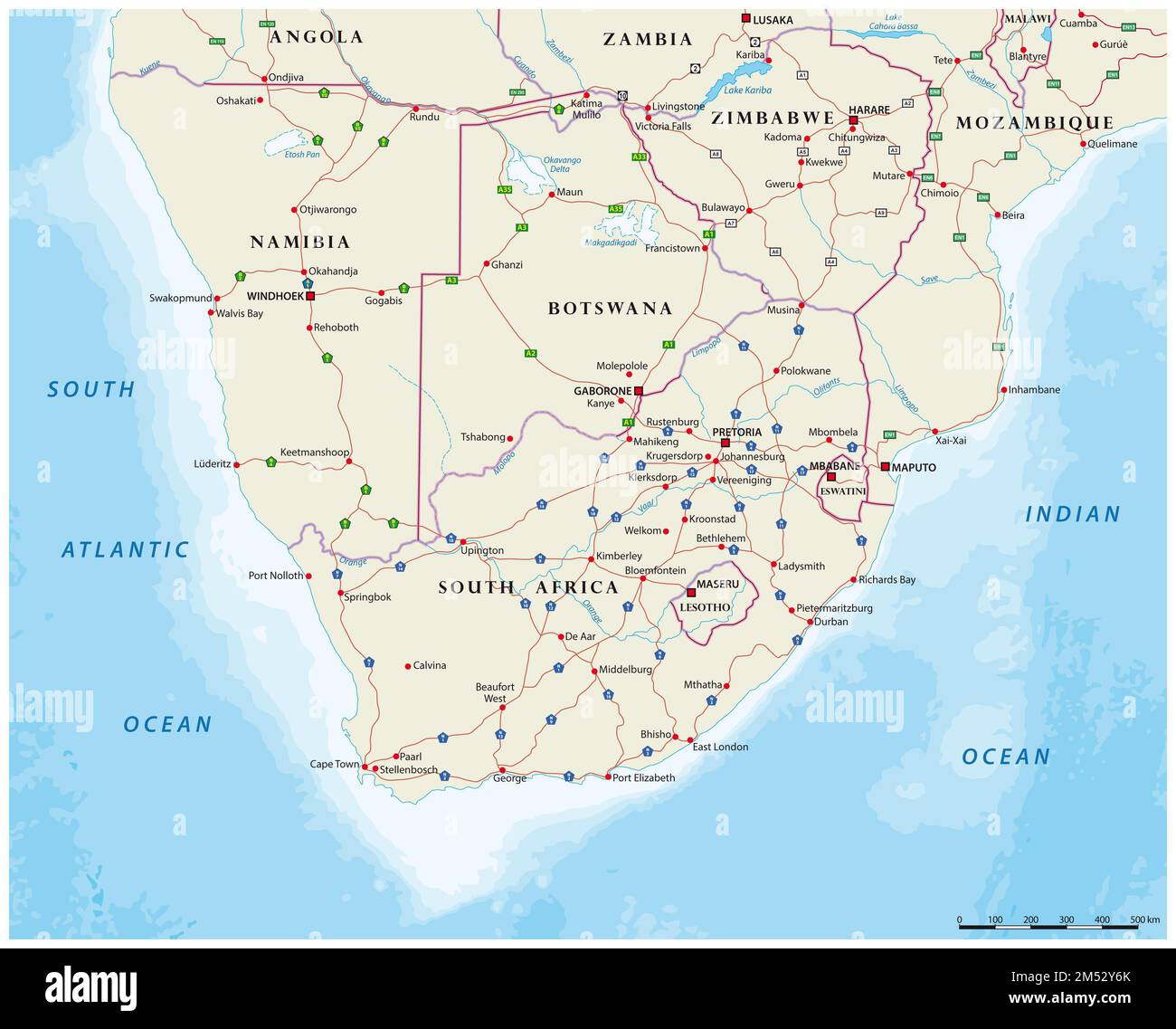 Road map degli stati dell'Africa meridionale Foto Stockhttps://www.alamy.it/image-license-details/?v=1https://www.alamy.it/road-map-degli-stati-dell-africa-meridionale-image502239211.html
RF2M52Y6K–Road map degli stati dell'Africa meridionale
 Bandiere del Sud Africa e del Lesotho per l'incontro ufficiale sullo sfondo della mappa mondiale. Illustrazione Vettorialehttps://www.alamy.it/image-license-details/?v=1https://www.alamy.it/bandiere-del-sud-africa-e-del-lesotho-per-l-incontro-ufficiale-sullo-sfondo-della-mappa-mondiale-image556052231.html
RF2R8JA87–Bandiere del Sud Africa e del Lesotho per l'incontro ufficiale sullo sfondo della mappa mondiale.
 Il Lesotho cartello stradale isolato su bianco Foto Stockhttps://www.alamy.it/image-license-details/?v=1https://www.alamy.it/foto-immagine-il-lesotho-cartello-stradale-isolato-su-bianco-116198212.html
RFGN1804–Il Lesotho cartello stradale isolato su bianco
 Bandiere di Zanzibar e Lesotho per l'incontro ufficiale sullo sfondo della mappa del mondo. Illustrazione Vettorialehttps://www.alamy.it/image-license-details/?v=1https://www.alamy.it/bandiere-di-zanzibar-e-lesotho-per-l-incontro-ufficiale-sullo-sfondo-della-mappa-del-mondo-image623824309.html
RF2Y6WJ7H–Bandiere di Zanzibar e Lesotho per l'incontro ufficiale sullo sfondo della mappa del mondo.
 Lesotho Mappa grigio Foto Stockhttps://www.alamy.it/image-license-details/?v=1https://www.alamy.it/foto-immagine-lesotho-mappa-grigio-169151246.html
RFKR5E3X–Lesotho Mappa grigio
 Il Sud Africa ha evidenziato in colore verde sulla mappa del mondo illustrazione vettoriale. Illustrazione Vettorialehttps://www.alamy.it/image-license-details/?v=1https://www.alamy.it/il-sud-africa-ha-evidenziato-in-colore-verde-sulla-mappa-del-mondo-illustrazione-vettoriale-image332594928.html
RF2A93068–Il Sud Africa ha evidenziato in colore verde sulla mappa del mondo illustrazione vettoriale.
 Africa ha contornato la mappa con il Sud Africa evidenziato. Mappa e bandiera del Sudafrica sulla mappa dell'Africa. Illustrazione vettoriale. Illustrazione Vettorialehttps://www.alamy.it/image-license-details/?v=1https://www.alamy.it/africa-ha-contornato-la-mappa-con-il-sud-africa-evidenziato-mappa-e-bandiera-del-sudafrica-sulla-mappa-dell-africa-illustrazione-vettoriale-image365827039.html
RF2C74T3B–Africa ha contornato la mappa con il Sud Africa evidenziato. Mappa e bandiera del Sudafrica sulla mappa dell'Africa. Illustrazione vettoriale.
 Sud Africa mappa illustrazione vettoriale, scribble schizzo fsa, Prince Edward Island, Marion Island, Illustrazione Vettorialehttps://www.alamy.it/image-license-details/?v=1https://www.alamy.it/foto-immagine-sud-africa-mappa-illustrazione-vettoriale-scribble-schizzo-fsa-prince-edward-island-marion-island-165680393.html
RFKHFB0W–Sud Africa mappa illustrazione vettoriale, scribble schizzo fsa, Prince Edward Island, Marion Island,
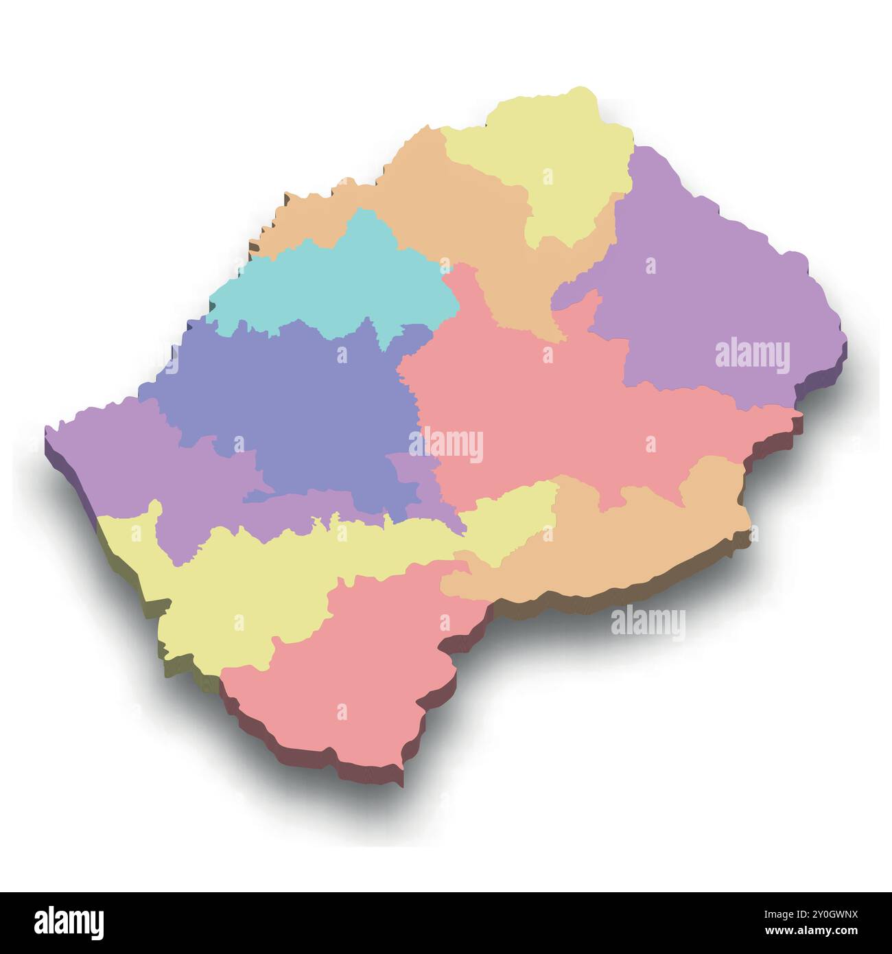 Mappa isometrica colorata 3d del Lesotho con bordi delle regioni Illustrazione Vettorialehttps://www.alamy.it/image-license-details/?v=1https://www.alamy.it/mappa-isometrica-colorata-3d-del-lesotho-con-bordi-delle-regioni-image619944694.html
RF2Y0GWNX–Mappa isometrica colorata 3d del Lesotho con bordi delle regioni
 Sud Africa mappa illustrazione vettoriale, scribble schizzo fsa, Prince Edward Island, Marion Island, Illustrazione Vettorialehttps://www.alamy.it/image-license-details/?v=1https://www.alamy.it/foto-immagine-sud-africa-mappa-illustrazione-vettoriale-scribble-schizzo-fsa-prince-edward-island-marion-island-164711865.html
RFKFY7JH–Sud Africa mappa illustrazione vettoriale, scribble schizzo fsa, Prince Edward Island, Marion Island,
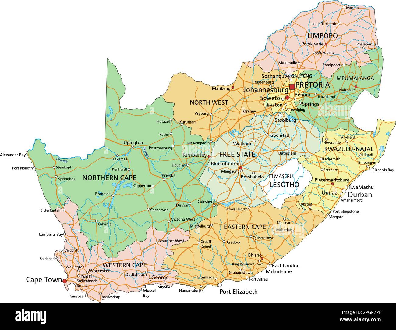 Sudafrica - Mappa politica modificabile molto dettagliata con etichettatura. Illustrazione Vettorialehttps://www.alamy.it/image-license-details/?v=1https://www.alamy.it/sudafrica-mappa-politica-modificabile-molto-dettagliata-con-etichettatura-image543866919.html
RF2PGR7PF–Sudafrica - Mappa politica modificabile molto dettagliata con etichettatura.
 Vettore stilizzati Lesotho mappa mostrando grandi città, capitale Maseru, divisioni amministrative. Illustrazione Vettorialehttps://www.alamy.it/image-license-details/?v=1https://www.alamy.it/vettore-stilizzati-lesotho-mappa-mostrando-grandi-citta-capitale-maseru-divisioni-amministrative-image217105273.html
RFPH5YYN–Vettore stilizzati Lesotho mappa mostrando grandi città, capitale Maseru, divisioni amministrative.
 Carta piegata mappa del Lesotho con bandiera pin del Lesotho. Illustrazione vettoriale Illustrazione Vettorialehttps://www.alamy.it/image-license-details/?v=1https://www.alamy.it/carta-piegata-mappa-del-lesotho-con-bandiera-pin-del-lesotho-illustrazione-vettoriale-image371680909.html
RF2CGKEP5–Carta piegata mappa del Lesotho con bandiera pin del Lesotho. Illustrazione vettoriale
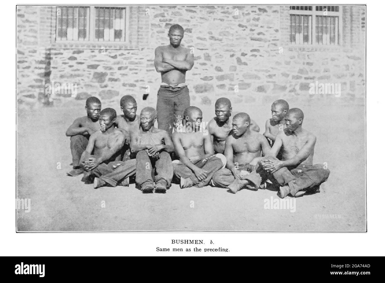 Fotografato a Breakwater, Città del Capo 1871 dal libro ' esemplari di folklore dei Boscimani ' di Bleek, W. H. I. (Wilhelm Heinrich Immanuel), Lloyd, Lucy Catherine, Theal, George McCall, 1837-1919 pubblicato a Londra da G. Allen & Company, ltd. Nel 1911. I popoli dei San (anche Saan), o Boscimani, sono membri di vari gruppi di cacciatori-raccoglitori indigeni di lingua khoe, Tuu, o Kxʼa, che sono le prime nazioni dell'Africa meridionale, e i cui territori si estendono dal Botswana, dalla Namibia, dall'Angola, dallo Zambia, dallo Zimbabwe, Lesotho e Sud Africa. Foto Stockhttps://www.alamy.it/image-license-details/?v=1https://www.alamy.it/fotografato-a-breakwater-citta-del-capo-1871-dal-libro-esemplari-di-folklore-dei-boscimani-di-bleek-w-h-i-wilhelm-heinrich-immanuel-lloyd-lucy-catherine-theal-george-mccall-1837-1919-pubblicato-a-londra-da-g-allen-company-ltd-nel-1911-i-popoli-dei-san-anche-saan-o-boscimani-sono-membri-di-vari-gruppi-di-cacciatori-raccoglitori-indigeni-di-lingua-khoe-tuu-o-kx-a-che-sono-le-prime-nazioni-dell-africa-meridionale-e-i-cui-territori-si-estendono-dal-botswana-dalla-namibia-dall-angola-dallo-zambia-dallo-zimbabwe-lesotho-e-sud-africa-image436562853.html
RM2GA74AD–Fotografato a Breakwater, Città del Capo 1871 dal libro ' esemplari di folklore dei Boscimani ' di Bleek, W. H. I. (Wilhelm Heinrich Immanuel), Lloyd, Lucy Catherine, Theal, George McCall, 1837-1919 pubblicato a Londra da G. Allen & Company, ltd. Nel 1911. I popoli dei San (anche Saan), o Boscimani, sono membri di vari gruppi di cacciatori-raccoglitori indigeni di lingua khoe, Tuu, o Kxʼa, che sono le prime nazioni dell'Africa meridionale, e i cui territori si estendono dal Botswana, dalla Namibia, dall'Angola, dallo Zambia, dallo Zimbabwe, Lesotho e Sud Africa.
 MASERU cartello stradale isolato su bianco Foto Stockhttps://www.alamy.it/image-license-details/?v=1https://www.alamy.it/foto-immagine-maseru-cartello-stradale-isolato-su-bianco-116198486.html
RFGN189X–MASERU cartello stradale isolato su bianco
 Distretti del Lesotho Mappa grigio Foto Stockhttps://www.alamy.it/image-license-details/?v=1https://www.alamy.it/foto-immagine-distretti-del-lesotho-mappa-grigio-169151241.html
RFKR5E3N–Distretti del Lesotho Mappa grigio
 Sud Africa mappa illustrazione vettoriale, scribble schizzo fsa, Prince Edward Island, Marion Island, Illustrazione Vettorialehttps://www.alamy.it/image-license-details/?v=1https://www.alamy.it/foto-immagine-sud-africa-mappa-illustrazione-vettoriale-scribble-schizzo-fsa-prince-edward-island-marion-island-164836300.html
RFKG4XAM–Sud Africa mappa illustrazione vettoriale, scribble schizzo fsa, Prince Edward Island, Marion Island,
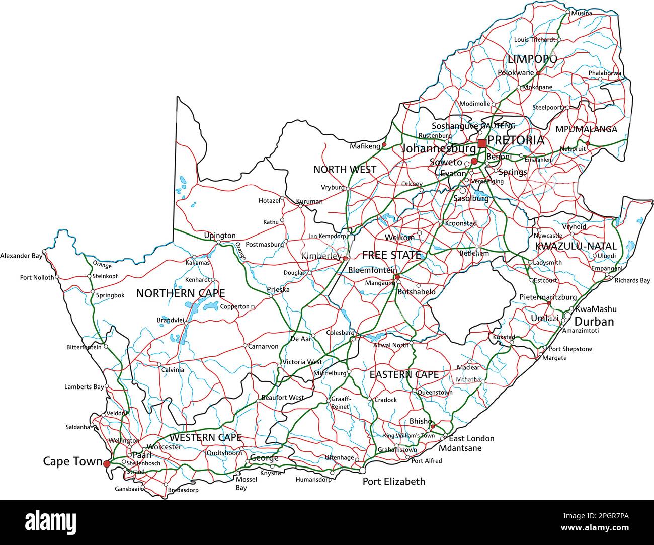 Mappa stradale dettagliata del Sudafrica con etichettatura. Illustrazione Vettorialehttps://www.alamy.it/image-license-details/?v=1https://www.alamy.it/mappa-stradale-dettagliata-del-sudafrica-con-etichettatura-image543866914.html
RF2PGR7PA–Mappa stradale dettagliata del Sudafrica con etichettatura.
 Lesotho mappa vettoriale. Modello modificabile con le regioni, le città, i pin di colore rosso e blu superficie su sfondo bianco. Illustrazione Vettorialehttps://www.alamy.it/image-license-details/?v=1https://www.alamy.it/lesotho-mappa-vettoriale-modello-modificabile-con-le-regioni-le-citta-i-pin-di-colore-rosso-e-blu-superficie-su-sfondo-bianco-image238540860.html
RFRT2D8C–Lesotho mappa vettoriale. Modello modificabile con le regioni, le città, i pin di colore rosso e blu superficie su sfondo bianco.
 Mafeteng District (distretti del Lesotho, Regno di Lesotho) mappa illustrazione vettoriale, scribble schizzo Mafeteng mappa Illustrazione Vettorialehttps://www.alamy.it/image-license-details/?v=1https://www.alamy.it/mafeteng-district-distretti-del-lesotho-regno-di-lesotho-mappa-illustrazione-vettoriale-scribble-schizzo-mafeteng-mappa-image344397137.html
RF2B08J1N–Mafeteng District (distretti del Lesotho, Regno di Lesotho) mappa illustrazione vettoriale, scribble schizzo Mafeteng mappa
 Set di vettore del Lesotho paese. Vista isometrica mappa in 3d, Lesotho mappa, mappa Africa - con regione, stato nomi e nomi di città. Illustrazione Vettorialehttps://www.alamy.it/image-license-details/?v=1https://www.alamy.it/set-di-vettore-del-lesotho-paese-vista-isometrica-mappa-in-3d-lesotho-mappa-mappa-africa-con-regione-stato-nomi-e-nomi-di-citta-image264081623.html
RFW9HXPF–Set di vettore del Lesotho paese. Vista isometrica mappa in 3d, Lesotho mappa, mappa Africa - con regione, stato nomi e nomi di città.
 Mokhotlong District (distretti del Lesotho, Regno di Lesotho) mappa illustrazione vettoriale, scribble schizzo Mokhotlong mappa Illustrazione Vettorialehttps://www.alamy.it/image-license-details/?v=1https://www.alamy.it/mokhotlong-district-distretti-del-lesotho-regno-di-lesotho-mappa-illustrazione-vettoriale-scribble-schizzo-mokhotlong-mappa-image344397153.html
RF2B08J29–Mokhotlong District (distretti del Lesotho, Regno di Lesotho) mappa illustrazione vettoriale, scribble schizzo Mokhotlong mappa
 Mokhotlong District (distretti del Lesotho, Regno di Lesotho) mappa illustrazione vettoriale, scribble schizzo Mokhotlong mappa Illustrazione Vettorialehttps://www.alamy.it/image-license-details/?v=1https://www.alamy.it/mokhotlong-district-distretti-del-lesotho-regno-di-lesotho-mappa-illustrazione-vettoriale-scribble-schizzo-mokhotlong-mappa-image338689175.html
RF2AK0HDY–Mokhotlong District (distretti del Lesotho, Regno di Lesotho) mappa illustrazione vettoriale, scribble schizzo Mokhotlong mappa
 Mokhotlong District (distretti del Lesotho, Regno di Lesotho) mappa illustrazione vettoriale, scribble schizzo Mokhotlong mappa Illustrazione Vettorialehttps://www.alamy.it/image-license-details/?v=1https://www.alamy.it/mokhotlong-district-distretti-del-lesotho-regno-di-lesotho-mappa-illustrazione-vettoriale-scribble-schizzo-mokhotlong-mappa-image342250312.html
RF2ATPRNC–Mokhotlong District (distretti del Lesotho, Regno di Lesotho) mappa illustrazione vettoriale, scribble schizzo Mokhotlong mappa
 Mafeteng District (distretti del Lesotho, Regno di Lesotho) mappa illustrazione vettoriale, scribble schizzo Mafeteng mappa Illustrazione Vettorialehttps://www.alamy.it/image-license-details/?v=1https://www.alamy.it/mafeteng-district-distretti-del-lesotho-regno-di-lesotho-mappa-illustrazione-vettoriale-scribble-schizzo-mafeteng-mappa-image342250512.html
RF2ATPT0G–Mafeteng District (distretti del Lesotho, Regno di Lesotho) mappa illustrazione vettoriale, scribble schizzo Mafeteng mappa
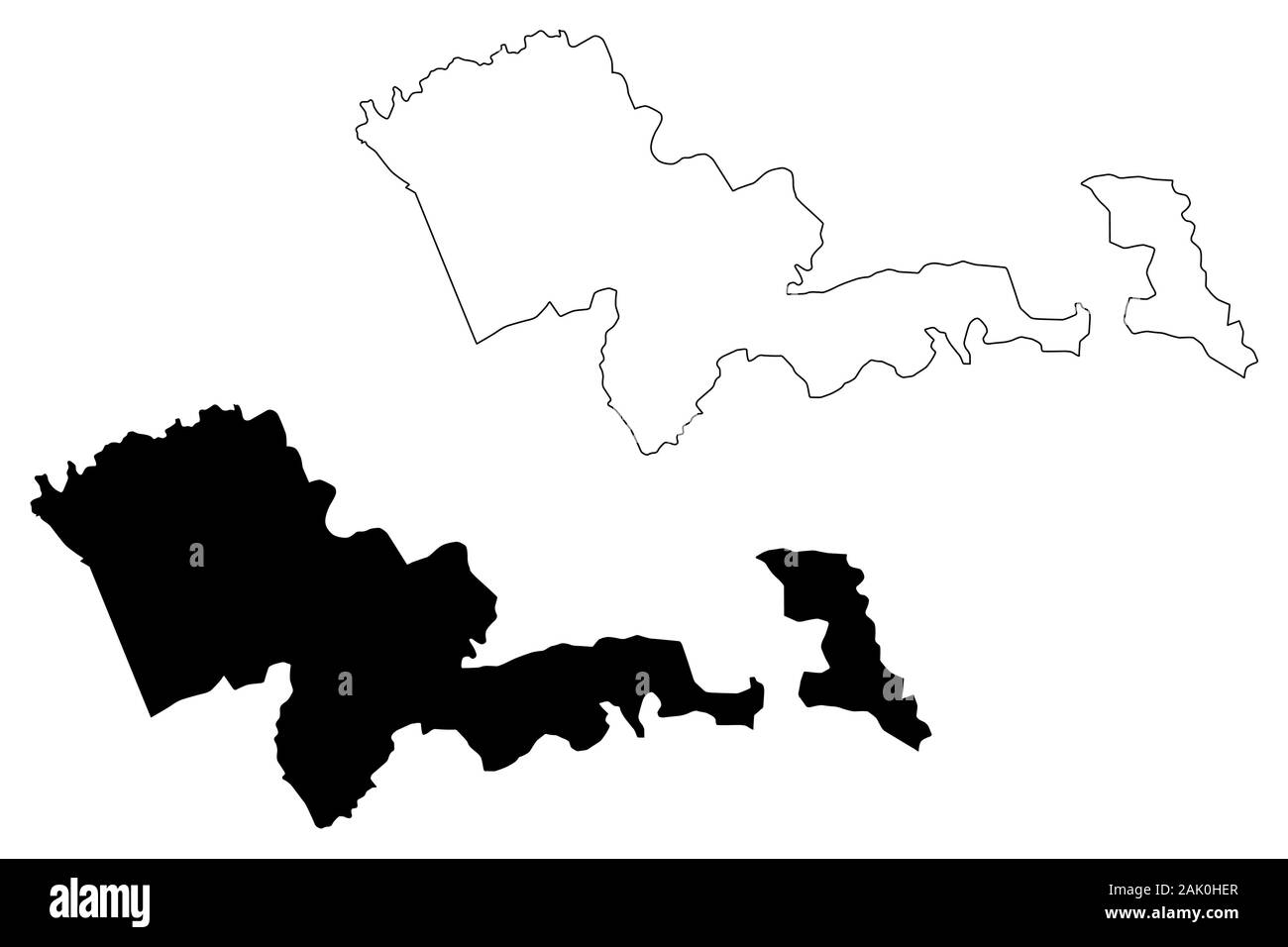 Mafeteng District (distretti del Lesotho, Regno di Lesotho) mappa illustrazione vettoriale, scribble schizzo Mafeteng mappa Illustrazione Vettorialehttps://www.alamy.it/image-license-details/?v=1https://www.alamy.it/mafeteng-district-distretti-del-lesotho-regno-di-lesotho-mappa-illustrazione-vettoriale-scribble-schizzo-mafeteng-mappa-image338689199.html
RF2AK0HER–Mafeteng District (distretti del Lesotho, Regno di Lesotho) mappa illustrazione vettoriale, scribble schizzo Mafeteng mappa
 Berea District (distretti del Lesotho, Regno di Lesotho) mappa illustrazione vettoriale, scribble schizzo Berea mappa Illustrazione Vettorialehttps://www.alamy.it/image-license-details/?v=1https://www.alamy.it/berea-district-distretti-del-lesotho-regno-di-lesotho-mappa-illustrazione-vettoriale-scribble-schizzo-berea-mappa-image338690437.html
RF2AK0K31–Berea District (distretti del Lesotho, Regno di Lesotho) mappa illustrazione vettoriale, scribble schizzo Berea mappa
 Maseru District (distretti del Lesotho, Regno di Lesotho) mappa illustrazione vettoriale, scribble schizzo Maseru mappa Illustrazione Vettorialehttps://www.alamy.it/image-license-details/?v=1https://www.alamy.it/maseru-district-distretti-del-lesotho-regno-di-lesotho-mappa-illustrazione-vettoriale-scribble-schizzo-maseru-mappa-image344397334.html
RF2B08J8P–Maseru District (distretti del Lesotho, Regno di Lesotho) mappa illustrazione vettoriale, scribble schizzo Maseru mappa
 Quthing District (distretti del Lesotho, Regno di Lesotho) mappa illustrazione vettoriale, scribble schizzo Quthing mappa Illustrazione Vettorialehttps://www.alamy.it/image-license-details/?v=1https://www.alamy.it/quthing-district-distretti-del-lesotho-regno-di-lesotho-mappa-illustrazione-vettoriale-scribble-schizzo-quthing-mappa-image342250314.html
RF2ATPRNE–Quthing District (distretti del Lesotho, Regno di Lesotho) mappa illustrazione vettoriale, scribble schizzo Quthing mappa
 Berea District (distretti del Lesotho, Regno di Lesotho) mappa illustrazione vettoriale, scribble schizzo Berea mappa Illustrazione Vettorialehttps://www.alamy.it/image-license-details/?v=1https://www.alamy.it/berea-district-distretti-del-lesotho-regno-di-lesotho-mappa-illustrazione-vettoriale-scribble-schizzo-berea-mappa-image342250020.html
RF2ATPRB0–Berea District (distretti del Lesotho, Regno di Lesotho) mappa illustrazione vettoriale, scribble schizzo Berea mappa
 Berea District (distretti del Lesotho, Regno di Lesotho) mappa illustrazione vettoriale, scribble schizzo Berea mappa Illustrazione Vettorialehttps://www.alamy.it/image-license-details/?v=1https://www.alamy.it/berea-district-distretti-del-lesotho-regno-di-lesotho-mappa-illustrazione-vettoriale-scribble-schizzo-berea-mappa-image344290591.html
RF2B03P4F–Berea District (distretti del Lesotho, Regno di Lesotho) mappa illustrazione vettoriale, scribble schizzo Berea mappa
 Leribe District (distretti del Lesotho, Regno di Lesotho) mappa illustrazione vettoriale, scribble schizzo Leribe mappa Illustrazione Vettorialehttps://www.alamy.it/image-license-details/?v=1https://www.alamy.it/leribe-district-distretti-del-lesotho-regno-di-lesotho-mappa-illustrazione-vettoriale-scribble-schizzo-leribe-mappa-image344397229.html
RF2B08J51–Leribe District (distretti del Lesotho, Regno di Lesotho) mappa illustrazione vettoriale, scribble schizzo Leribe mappa
 Quthing District (distretti del Lesotho, Regno di Lesotho) mappa illustrazione vettoriale, scribble schizzo Quthing mappa Illustrazione Vettorialehttps://www.alamy.it/image-license-details/?v=1https://www.alamy.it/quthing-district-distretti-del-lesotho-regno-di-lesotho-mappa-illustrazione-vettoriale-scribble-schizzo-quthing-mappa-image338689179.html
RF2AK0HE3–Quthing District (distretti del Lesotho, Regno di Lesotho) mappa illustrazione vettoriale, scribble schizzo Quthing mappa
 Leribe District (distretti del Lesotho, Regno di Lesotho) mappa illustrazione vettoriale, scribble schizzo Leribe mappa Illustrazione Vettorialehttps://www.alamy.it/image-license-details/?v=1https://www.alamy.it/leribe-district-distretti-del-lesotho-regno-di-lesotho-mappa-illustrazione-vettoriale-scribble-schizzo-leribe-mappa-image342250225.html
RF2ATPRJ9–Leribe District (distretti del Lesotho, Regno di Lesotho) mappa illustrazione vettoriale, scribble schizzo Leribe mappa
 Maseru District (distretti del Lesotho, Regno di Lesotho) mappa illustrazione vettoriale, scribble schizzo Maseru mappa Illustrazione Vettorialehttps://www.alamy.it/image-license-details/?v=1https://www.alamy.it/maseru-district-distretti-del-lesotho-regno-di-lesotho-mappa-illustrazione-vettoriale-scribble-schizzo-maseru-mappa-image342250406.html
RF2ATPRTP–Maseru District (distretti del Lesotho, Regno di Lesotho) mappa illustrazione vettoriale, scribble schizzo Maseru mappa
 Maseru District (distretti del Lesotho, Regno di Lesotho) mappa illustrazione vettoriale, scribble schizzo Maseru mappa Illustrazione Vettorialehttps://www.alamy.it/image-license-details/?v=1https://www.alamy.it/maseru-district-distretti-del-lesotho-regno-di-lesotho-mappa-illustrazione-vettoriale-scribble-schizzo-maseru-mappa-image338689282.html
RF2AK0HHP–Maseru District (distretti del Lesotho, Regno di Lesotho) mappa illustrazione vettoriale, scribble schizzo Maseru mappa
 Lesotho - Mappa è progettato rainbow abstract pattern colorati, Regno di Lesotho mappa fatta di esplosione di colori, Illustrazione Vettorialehttps://www.alamy.it/image-license-details/?v=1https://www.alamy.it/lesotho-mappa-e-progettato-rainbow-abstract-pattern-colorati-regno-di-lesotho-mappa-fatta-di-esplosione-di-colori-image247217237.html
RFTA5M31–Lesotho - Mappa è progettato rainbow abstract pattern colorati, Regno di Lesotho mappa fatta di esplosione di colori,
 Quthing District (distretti del Lesotho, Regno di Lesotho) mappa illustrazione vettoriale, scribble schizzo Quthing mappa Illustrazione Vettorialehttps://www.alamy.it/image-license-details/?v=1https://www.alamy.it/quthing-district-distretti-del-lesotho-regno-di-lesotho-mappa-illustrazione-vettoriale-scribble-schizzo-quthing-mappa-image344397219.html
RF2B08J4K–Quthing District (distretti del Lesotho, Regno di Lesotho) mappa illustrazione vettoriale, scribble schizzo Quthing mappa
 Leribe District (distretti del Lesotho, Regno di Lesotho) mappa illustrazione vettoriale, scribble schizzo Leribe mappa Illustrazione Vettorialehttps://www.alamy.it/image-license-details/?v=1https://www.alamy.it/leribe-district-distretti-del-lesotho-regno-di-lesotho-mappa-illustrazione-vettoriale-scribble-schizzo-leribe-mappa-image338690429.html
RF2AK0K2N–Leribe District (distretti del Lesotho, Regno di Lesotho) mappa illustrazione vettoriale, scribble schizzo Leribe mappa
 Città di Maseru (Regno del Lesotho, capitale) mappa illustrazione vettoriale, abbozzare città di Maseru mappa Illustrazione Vettorialehttps://www.alamy.it/image-license-details/?v=1https://www.alamy.it/citta-di-maseru-regno-del-lesotho-capitale-mappa-illustrazione-vettoriale-abbozzare-citta-di-maseru-mappa-image383448178.html
RF2D7RG1P–Città di Maseru (Regno del Lesotho, capitale) mappa illustrazione vettoriale, abbozzare città di Maseru mappa
 Città di Maseru (Regno del Lesotho, capitale) mappa illustrazione vettoriale, abbozzare città di Maseru mappa Illustrazione Vettorialehttps://www.alamy.it/image-license-details/?v=1https://www.alamy.it/citta-di-maseru-regno-del-lesotho-capitale-mappa-illustrazione-vettoriale-abbozzare-citta-di-maseru-mappa-image376318513.html
RF2CT6P2W–Città di Maseru (Regno del Lesotho, capitale) mappa illustrazione vettoriale, abbozzare città di Maseru mappa
 Città di Maseru (Regno del Lesotho, capitale) mappa illustrazione vettoriale, abbozzare città di Maseru mappa Illustrazione Vettorialehttps://www.alamy.it/image-license-details/?v=1https://www.alamy.it/citta-di-maseru-regno-del-lesotho-capitale-mappa-illustrazione-vettoriale-abbozzare-citta-di-maseru-mappa-image384934164.html
RF2DA77CM–Città di Maseru (Regno del Lesotho, capitale) mappa illustrazione vettoriale, abbozzare città di Maseru mappa
 Qachas Nek District (distretti del Lesotho, Regno di Lesotho) mappa illustrazione vettoriale, scribble sketch di Qacha Nek mappa Illustrazione Vettorialehttps://www.alamy.it/image-license-details/?v=1https://www.alamy.it/qachas-nek-district-distretti-del-lesotho-regno-di-lesotho-mappa-illustrazione-vettoriale-scribble-sketch-di-qacha-nek-mappa-image342250248.html
RF2ATPRK4–Qachas Nek District (distretti del Lesotho, Regno di Lesotho) mappa illustrazione vettoriale, scribble sketch di Qacha Nek mappa
 Distretto Thaba-Tseka (distretti del Lesotho, Regno di Lesotho) mappa illustrazione vettoriale, scribble schizzo Thaba Tseka mappa Illustrazione Vettorialehttps://www.alamy.it/image-license-details/?v=1https://www.alamy.it/distretto-thaba-tseka-distretti-del-lesotho-regno-di-lesotho-mappa-illustrazione-vettoriale-scribble-schizzo-thaba-tseka-mappa-image342250232.html
RF2ATPRJG–Distretto Thaba-Tseka (distretti del Lesotho, Regno di Lesotho) mappa illustrazione vettoriale, scribble schizzo Thaba Tseka mappa
 Mohales Hoek District (distretti del Lesotho, Regno di Lesotho) mappa illustrazione vettoriale, scribble schizzo Mohale s Hoek mappa Illustrazione Vettorialehttps://www.alamy.it/image-license-details/?v=1https://www.alamy.it/mohales-hoek-district-distretti-del-lesotho-regno-di-lesotho-mappa-illustrazione-vettoriale-scribble-schizzo-mohale-s-hoek-mappa-image338690444.html
RF2AK0K38–Mohales Hoek District (distretti del Lesotho, Regno di Lesotho) mappa illustrazione vettoriale, scribble schizzo Mohale s Hoek mappa
 Distretto Butha-Buthe (distretti del Lesotho, Regno di Lesotho) mappa illustrazione vettoriale, scribble schizzo Butha Buthe mappa Illustrazione Vettorialehttps://www.alamy.it/image-license-details/?v=1https://www.alamy.it/distretto-butha-buthe-distretti-del-lesotho-regno-di-lesotho-mappa-illustrazione-vettoriale-scribble-schizzo-butha-buthe-mappa-image344290501.html
RF2B03P19–Distretto Butha-Buthe (distretti del Lesotho, Regno di Lesotho) mappa illustrazione vettoriale, scribble schizzo Butha Buthe mappa
 Qachas Nek District (distretti del Lesotho, Regno di Lesotho) mappa illustrazione vettoriale, scribble sketch di Qacha Nek mappa Illustrazione Vettorialehttps://www.alamy.it/image-license-details/?v=1https://www.alamy.it/qachas-nek-district-distretti-del-lesotho-regno-di-lesotho-mappa-illustrazione-vettoriale-scribble-sketch-di-qacha-nek-mappa-image344397231.html
RF2B08J53–Qachas Nek District (distretti del Lesotho, Regno di Lesotho) mappa illustrazione vettoriale, scribble sketch di Qacha Nek mappa
 Distretto Thaba-Tseka (distretti del Lesotho, Regno di Lesotho) mappa illustrazione vettoriale, scribble schizzo Thaba Tseka mappa Illustrazione Vettorialehttps://www.alamy.it/image-license-details/?v=1https://www.alamy.it/distretto-thaba-tseka-distretti-del-lesotho-regno-di-lesotho-mappa-illustrazione-vettoriale-scribble-schizzo-thaba-tseka-mappa-image344397327.html
RF2B08J8F–Distretto Thaba-Tseka (distretti del Lesotho, Regno di Lesotho) mappa illustrazione vettoriale, scribble schizzo Thaba Tseka mappa
 Distretto Butha-Buthe (distretti del Lesotho, Regno di Lesotho) mappa illustrazione vettoriale, scribble schizzo Butha Buthe mappa Illustrazione Vettorialehttps://www.alamy.it/image-license-details/?v=1https://www.alamy.it/distretto-butha-buthe-distretti-del-lesotho-regno-di-lesotho-mappa-illustrazione-vettoriale-scribble-schizzo-butha-buthe-mappa-image338690454.html
RF2AK0K3J–Distretto Butha-Buthe (distretti del Lesotho, Regno di Lesotho) mappa illustrazione vettoriale, scribble schizzo Butha Buthe mappa
 Qachas Nek District (distretti del Lesotho, Regno di Lesotho) mappa illustrazione vettoriale, scribble sketch di Qacha Nek mappa Illustrazione Vettorialehttps://www.alamy.it/image-license-details/?v=1https://www.alamy.it/qachas-nek-district-distretti-del-lesotho-regno-di-lesotho-mappa-illustrazione-vettoriale-scribble-sketch-di-qacha-nek-mappa-image338690986.html
RF2AK0KPJ–Qachas Nek District (distretti del Lesotho, Regno di Lesotho) mappa illustrazione vettoriale, scribble sketch di Qacha Nek mappa
 Distretto Butha-Buthe (distretti del Lesotho, Regno di Lesotho) mappa illustrazione vettoriale, scribble schizzo Butha Buthe mappa Illustrazione Vettorialehttps://www.alamy.it/image-license-details/?v=1https://www.alamy.it/distretto-butha-buthe-distretti-del-lesotho-regno-di-lesotho-mappa-illustrazione-vettoriale-scribble-schizzo-butha-buthe-mappa-image342250361.html
RF2ATPRR5–Distretto Butha-Buthe (distretti del Lesotho, Regno di Lesotho) mappa illustrazione vettoriale, scribble schizzo Butha Buthe mappa
 Lesotho - Mappa è progettato Cannabis leaf verde e nero, Regno di Lesotho mappa fatta di marijuana (marihuana,THC) Fogliame, Illustrazione Vettorialehttps://www.alamy.it/image-license-details/?v=1https://www.alamy.it/lesotho-mappa-e-progettato-cannabis-leaf-verde-e-nero-regno-di-lesotho-mappa-fatta-di-marijuana-marihuana-thc-fogliame-image243860090.html
RFT4MP0X–Lesotho - Mappa è progettato Cannabis leaf verde e nero, Regno di Lesotho mappa fatta di marijuana (marihuana,THC) Fogliame,
 Mohales Hoek District (distretti del Lesotho, Regno di Lesotho) mappa illustrazione vettoriale, scribble schizzo Mohale s Hoek mappa Illustrazione Vettorialehttps://www.alamy.it/image-license-details/?v=1https://www.alamy.it/mohales-hoek-district-distretti-del-lesotho-regno-di-lesotho-mappa-illustrazione-vettoriale-scribble-schizzo-mohale-s-hoek-mappa-image342250438.html
RF2ATPRWX–Mohales Hoek District (distretti del Lesotho, Regno di Lesotho) mappa illustrazione vettoriale, scribble schizzo Mohale s Hoek mappa
 Distretto Thaba-Tseka (distretti del Lesotho, Regno di Lesotho) mappa illustrazione vettoriale, scribble schizzo Thaba Tseka mappa Illustrazione Vettorialehttps://www.alamy.it/image-license-details/?v=1https://www.alamy.it/distretto-thaba-tseka-distretti-del-lesotho-regno-di-lesotho-mappa-illustrazione-vettoriale-scribble-schizzo-thaba-tseka-mappa-image338690952.html
RF2AK0KNC–Distretto Thaba-Tseka (distretti del Lesotho, Regno di Lesotho) mappa illustrazione vettoriale, scribble schizzo Thaba Tseka mappa
 Mohales Hoek District (distretti del Lesotho, Regno di Lesotho) mappa illustrazione vettoriale, scribble schizzo Mohale s Hoek mappa Illustrazione Vettorialehttps://www.alamy.it/image-license-details/?v=1https://www.alamy.it/mohales-hoek-district-distretti-del-lesotho-regno-di-lesotho-mappa-illustrazione-vettoriale-scribble-schizzo-mohale-s-hoek-mappa-image344397336.html
RF2B08J8T–Mohales Hoek District (distretti del Lesotho, Regno di Lesotho) mappa illustrazione vettoriale, scribble schizzo Mohale s Hoek mappa