12254 x 8360 px | 103,8 x 70,8 cm | 40,8 x 27,9 inches | 300dpi
Data acquisizione:
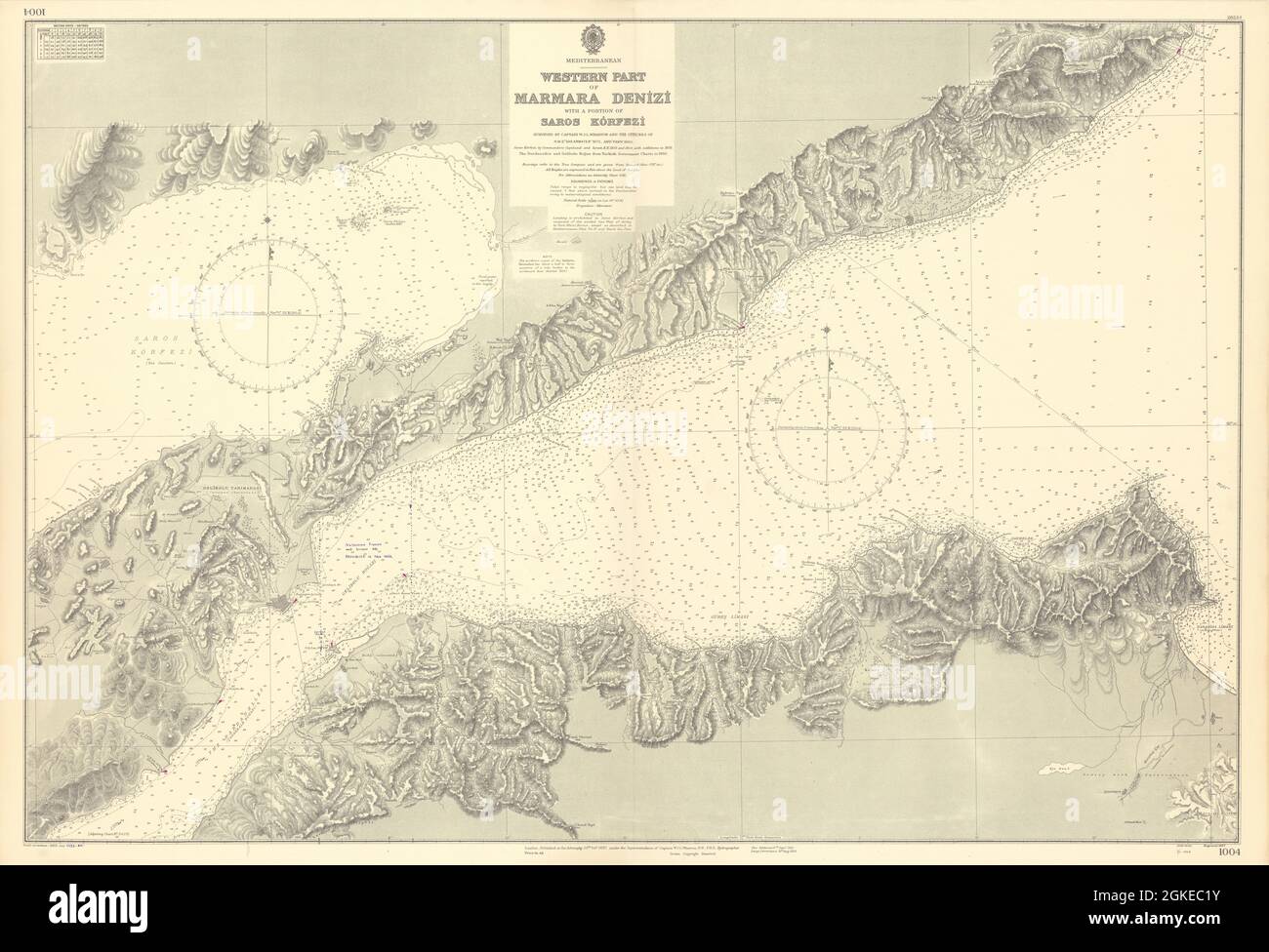
1955
Ubicazione:
Turkey
Altre informazioni:
Questa immagine potrebbe avere delle imperfezioni perché è storica o di reportage.
Mediterranean - Western Part of Marmara Denizi with a portion of Saros Körfezi. Artist/engraver/cartographer: Surveyed by Captain W.J.L. Wharton and the Officers of H.M.S."Shearwater" 1872, and " Fawn" 1880. Saros Körfezi by Commanders Copeland and Spratt, R.N., 1833 and 1854, with additions to 1878. The Dardanelles and Gelibolu Boğazi from Turkish Government charts to 1950. Provenance: London. Published at the Admiralty under the Superintendence of Captain W.J.L. Wharton, R.N., F.R.S., Hydrographer. Crown Copyright reserved. Type: Large British nautical sea chart. Sea charts such as this were working navigational aids which were commonly updated and corrected during their working lives by hand annotation and/or printed overlays. They may also feature manuscript navigational notes, comments or other markings.