Questa immagine potrebbe avere delle imperfezioni perché è storica o di reportage.
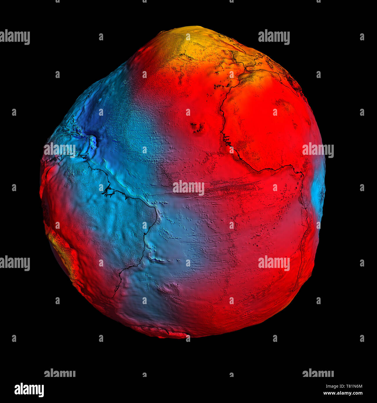
Earth's geoid. Image produced from data obtained by the ESA's (European Space Agency) GOCE (Gravity Field and Steady-State Ocean Circulation Explorer) 'Earth Explorer' mission, showing the Earth's geoid. The geoid is the surface of an ideal global ocean in the absence of tides and currents, shaped only by gravity. This image therefore shows the varying strength of the Earth's gravitational field across its surface. A precise model of Earth's geoid is crucial for deriving accurate measurements of ocean circulation, sea-level change and terrestrial ice dynamics. The geoid is also used as a reference surface from which to map the topographical features on the planet. In addition, a better understanding of variations in the gravity field will lead to a deeper understanding of Earth's interior, such as the physics and dynamics associated with volcanic activity and earthquakes.