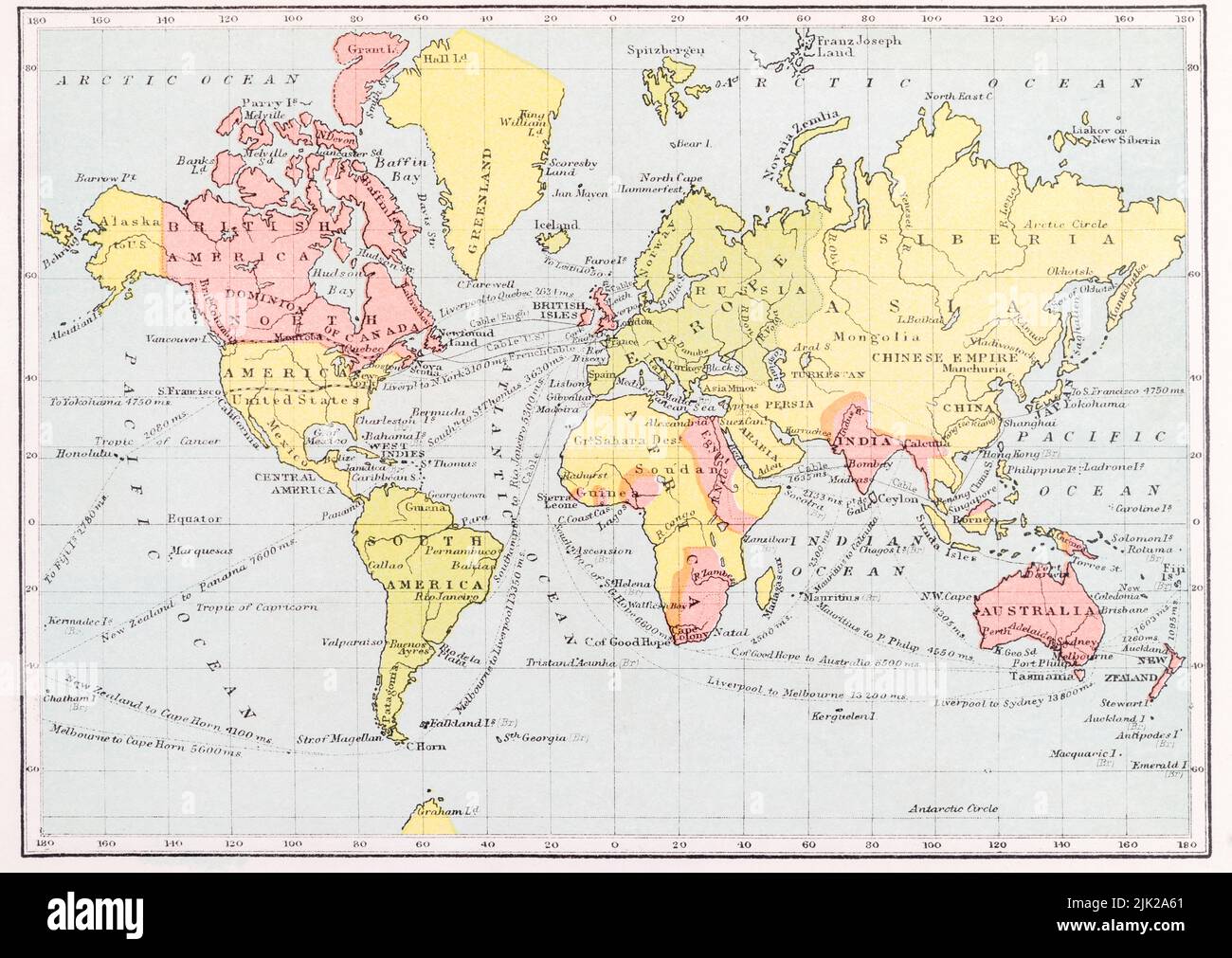
Vista vittoriana britannica del diciannovesimo secolo (colonie in rosso) del mondo secondo la proiezione di Mercatore. Mappa da metà 1890 's New Victoria Shilling Atlas
7706 x 5460 px | 65,2 x 46,2 cm | 25,7 x 18,2 inches | 300dpi
Data acquisizione:
28 luglio 2022
Ubicazione:
uk
Altre informazioni:
Image of map in The New Victoria Shilling Atlas published by George Gill & Sos Ltd., UK. Publication date unknown but an identical copy with a personal inscription dated 1898 puts it then or before, while I have seen reference to it being published around 1895. The Gill company were based at 12 Warwick Lane in London and only ceased trading in 1941. The original Gill died on November 24, 1901, while his sons, George Reginald Gill (1862 - ?) and Claude Edward Gill (August 30, 1872 - August 16, 1960), took over. I am not sure how that leaves us with rights for these so have put Editorial Only..... By all accounts (at least according to the Bodleian Library) general map copyright in the UK exists for 70 years after the date of publication - and not 70 years after the author's / originator's death as with literary works. See https://www.bodleian.ox.ac.uk/maps/reproducing-maps
Disponibile solo per utilizzo editoriale.
Uso relativo a notizie, recensioni e critiche e alla comunicazione di informazioni che riguardano persone, luoghi, cose, eventi o avvenimenti.
Per maggior chiarezza, l'uso editoriale non include alcun uso relativo a pubblicità, promozione (ad esempio siti web promozionali), marketing, packaging o merchandising.